
Introduction
The GSI releases useful digital map data, specially Digital Map 50 m Grid (Elevation) has high resolution and be used effectively in many area of industries and hobbies. But this product does not include Japanese Northern Territories elevation data (Japanese Northern Territories consist of 4 islands: Kunashiri, Etorofu, Habomai, and Shikotan islands. These islands are not included so called "Kuril Islands" in political meaning.).
By the way, there are raster image digital maps in GSI's products. We make MEM format files from contour data of "Digital Map 200000 (Map Image)" by hand. We sell it by online now.
Because we are making it completely by hand, there are following weak points in our MEM files comparing to original GSI's MEM file; we declare.
| 1. | Accuracy of elevation data is around 100 m with averaging, because accuracy of a contour of original data is aroung 100 m. |
| 2. | With averaging, resolution of elevation is 10 m, but it is worse than MEM files of GSI original (it is 1 m). |
| 3. | Adjustment is done for avoiding stair shape with too less averaging, and for avoiding lose fineness with too much averaging. |
| 4. | There are some parts with line or stair at the edge of MEM file, because of hand-made operation. |
| 5. | The header of the file is mostly compatible to MEM file, but we do not guarantee complete operation of all software which utilizes MEM file. |
Photo Gallery
Watching photos is the easiest way to understand our product. For example, we use a famous 3D map engine KASHMIR 3D. First, please look whole 2D view of Northern territories. (Click to magnify.) If you will put GSI's MEM files of Japan main land in the folder which contains our products MEM files, you can see Shiretoko peninsula and Nemuro peninsula simultaneously.

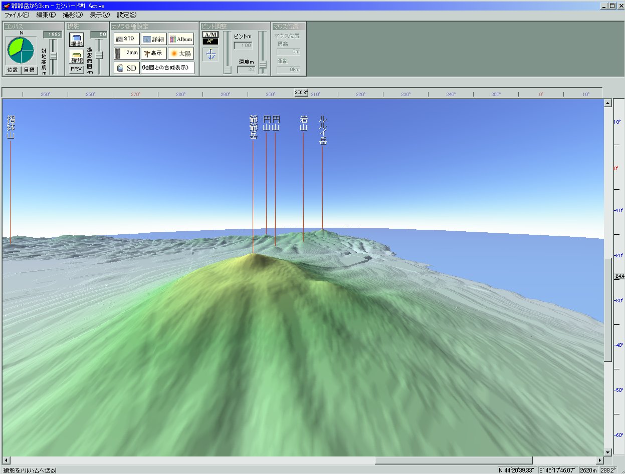
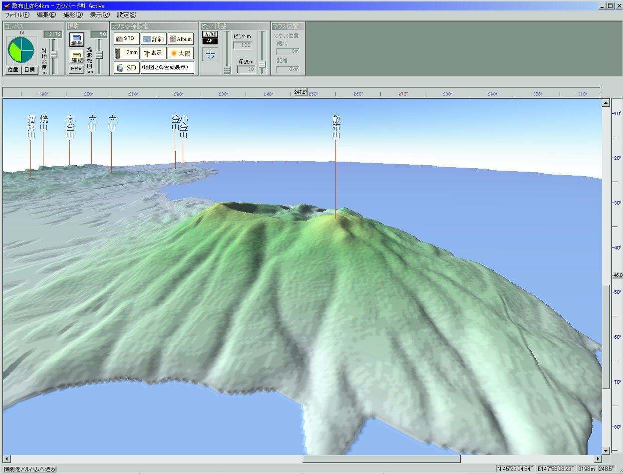
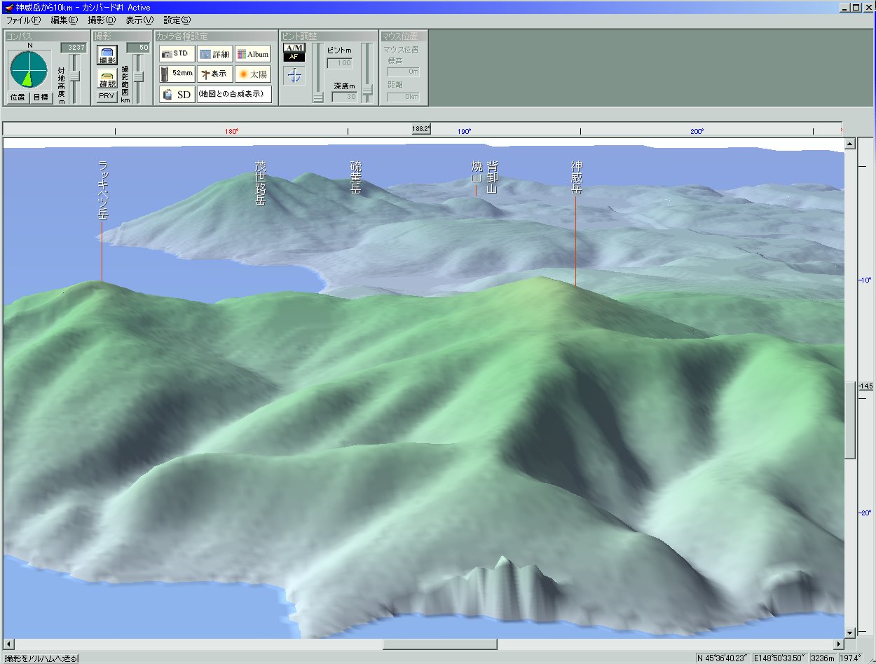
The next is 3D landscape. Click to magnify. First one is Mt. Chacha in Kunashiri island. Second two are Mt. Chirippu, and Mt. Kamui in Etorofu island.
We give a free MEM file sample from HERE. The location is the south edge of Kunashiri island. Please use it.
And we make Microsoft Flight Simulator scenery using this MEM files at HERE.
Further, in the product, there are not only complete MEM files, but also original Excel files for making MEM files together. You can make your original map with using it, the application range expands infinitely.
How to buy
Using credit card
Please click HERE, and you can buy it using credit card. After completion of the procedure, we will send your ID and password by e-mail. But you cannot go directry to download page after paying. After we check manually, we send you e-mail. So it may be takes some days usually. Thank you very much.
Using cash or check
Please click HERE and mail to us. And we will send a reply. Thank you.
This digital map gets an approval from GSI for release.
(Approval number : Hei 14 Sou-Shi #344 )
If you want to contact us about this product, plese click please click HERE.